Tuesday, July 5, 2011

A busy few weeks of Kerry Climbing...

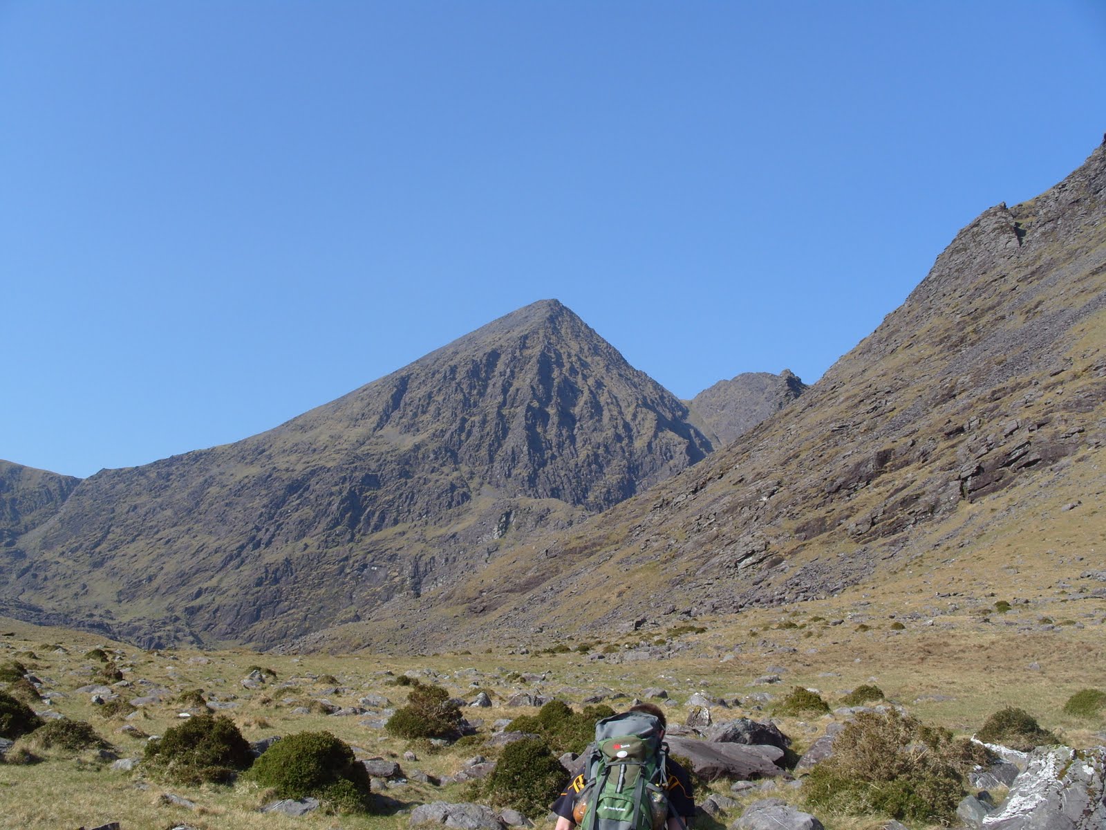
The mixed bag that is our Irish summer hasn't deterred walkers and climbers alike from getting out and making the most of the our magnificent mountains and hills.A massive congrats and a very well done to all the first time ascentionists of Corrán Tuathail in particular.We have had days of Torrential rain accompanied by savage winds followed by days of summer sunshine and sun-burnt faces.. Even though the views have been somewhat "disappointing"at times to say the least, the reward has always been worth the effort none the less...


We have guided all manner of routes recently,from steep roped climbs like the classic "Howling ridge" to the spectacular and long treks of "O'Sheas"  and Caher...We have guided the Easy to the Exhausting!!!We have had scorchio days on Torc and saturated days on Purple mountain...But when the day has ended,the legs are again rested, and the belly is  fed and watered,you can be content in the feeling of truly having experienced the adventure of Kerry...
We have plenty more fantastic adventures and climbs planned for the rest of July so have a look at some of the dates(posted on the left) and see does one suit... if it doesn't please let us know and we will do our best to accommodate you on a day that suits you better....

Tuesday, June 14, 2011

Footbridges provide vital access to Corrán Tuathail...


TWO footbridges providing access to Ireland’s highest mountain Corrán Tuathail along with a car park for hillwalkers, were officially opened recently in the MacGillycuddy’s Reeks.

The mountain hosts tens of thousands of climbers each year.

The €150,000 project, sponsored by Kerry County Council and Fáilte Ireland, also saw generous support form the local community, including the donation of land at Lisleibane by Donal O’Connor.
 
The steel footbridges were made and donated by the Killarney-based German crane company Liebherr Ireland.


"This project provides a much needed carpark at Lisleibane, Beaufort, serving Carrauntoohil, and two footbridges in the Hags Glen area of Carrauntoohil, allowing hillwalkers to safely enjoy the experience of walking Ireland’s highest mountain," said Minister Jimmy Deenihan who performed the official opening.

"The designation of the Reeks as a candidate special area of conservation is important to protect the intrinsic heritage of the county and the development of walks allows locals and visitors to the county the opportunity to take in the peace and tranquillity of our highest mountain," he said.

The footbridges were named in honour of a local community activist, the late Patie O’Shea and the late Angela Kenny, a young woman who drowned a number of years ago in that area.

Mayor of Kerry, Cllr Pat Leahy said: "The safety of hillwalkers is very important and the carpark— which serves Carrauntoohil — allows for ample parking for tourists and hillwalkers," he said.

Lisleibane is one of two carparks now serving the Reeks area,the other being "Cronins- yard"...the more traditional starting point for ascents of Corrán tuathail.


Monday, June 6, 2011

The Feral Goats of Corrán Tuathail...

If you have ever  climbed or descended Corrán Tuathail via the "3 levels" or Coum's, you may have spotted the family of Feral Goats....

 What does ‘feral’ mean?
The word feral means that these goats are descended from domesticated or farm animals, rather than coming from a native wild population. The nearest native wild goats and sheep occur in the Alps and south-eastern Europe, so any ‘wild’ goats here were originally brought over by humans.
When were goats first brought to Ireland?
It is thought that the first goats were brought over about 4000 years ago. Goats were very useful and hardy animals, kept for their milk, meat, hair and hides. Over time, some escaped and others were released, eventually forming wild populations. Even now, you will occasionally see a formerly domestic, soon-to-be-wild goat joining a feral herd.
Where do feral goats live?
Most feral goat herds in Ireland are in remote, mountainous areas. The most famous herds are in Killarney, the Burren and Glendalough, but there are also smaller populations in other hilly areas such as the Mournes, Connemara and Waterford.
What do feral goats look like?
The male is known as a billy, the female as a nanny, and the young as a kid. Both billies and nannies have a beard, and long horns sweeping back from the head, with males growing longer horns. The coat is long and shaggy and may be black, brown, white or grey, often mixed in various patterns.
Do feral goats live in groups?
Like most ruminants (grazing mammals with cloven hooves and a chambered stomach) feral goats are herd animals. Herds are led by a dominant female with up to a dozen other females. Males usually live in separate herds, but sometimes herds of up to 100 can be seen, if goats are driven down into valleys by bad weather.
When are kids born?
The breeding season, known as the rut, occurs between August and December. The billies display their fitness by shaking their heads, lowering their horns and occasionally head-butting other males. Gestation is about 5 months, so the kids are born in spring.
What do feral goats eat?
Goats have a reputation for eating everything and anything, but it’s unlikely that they’ll actually eat the clothes off your washing line! They do, however, eat any vegetation they find, such as grasses, sedges, heather and bilberry in the mountains, young trees and shrubs in woodlands, and even seaweeds on the coast. Like all ruminants, goats have a stomach divided into four compartments, for digesting tough plant material.
Do feral goats have any predators?
In modern-day Ireland, nothing hunts feral goats for food; not even humans. Up until 200 years ago, the wolf may have been their main predator. However, if numbers of goats increase to the point that they damage their surrounding habitat, e.g. eating young tree saplings, some goats may have to be culled by National Park staff, foresters and other land managers.
How long do feral goats live?
In the wild, despite the ancient appearance of some individuals, the average natural lifespan is about 8 years.
Do feral goats make noises?
Like their domestic cousins, feral goats make a bleating sound probably best transcribed as ‘meh-eh-eh-eh-eh’. In spring, the high-pitched bleating of the kids in the mountains can sound worryingly similar to somebody in distress and calling for help!
How do feral goats climb on cliffs?
For a large animal, goats are very agile on cliffs, jumping from ledge to ledge to reach plants and shrubs growing on almost sheer cliffs. As well as having naturally good balance, the hooves of the feet have a hard outer rim and a spongy surface underneath. These act like suckers, helping the goat to gain a firmer hold and better leverage on the rock.
Are feral goats protected?
For a non-native animal, goats have quite a high profile in Irish culture. Their many uses over the centuries (eg milk for cheese, skin for bodhrans). their association with wild mountainous areas and their stubborn independent spirit means that many people  regard them with fondness. Although goats are sometimes culled to protect sensitive habitats, it is not permitted to hunt them   without a permit.

Saturday, June 4, 2011

Great weather for Corrán Tuathail...3rd June...


Fantastic weather yesterday for Pauls first ascent of Irelands highest...We left Cronins yard at 10am and the sun was splitting stones as we trekked up the Hags Glen....We were climbing via "Brother O'Sheas gully"(named after the man who lost his life in a climbing accident here in 1968)....

Paul is hoping to climb Mont Blanc in September and so this was the first of his training days which he's planned to prepare for the climb. The mountains of the Reeks are truly amazing and all the more so on such a "scorchio"day. As we left Loch Gouragh and ascended the 3 tiers it almost felt like we had the mountains to ourselves!!!
The final slog up "O'Sheas" really gave Paul the test of fitness and stamina he needed, as we emerged onto the magnificent Beenkeragh ridge.... 15 minutes later Paul was finally at the summit cross with the amazing views spread out beneath us....We descended by the "Heavenly Gates" track, and as we neared the Gates it was great to see so many climbing parties on Howling Ridge!!! There was even a queue starting to build as another pair of climbers had just finished up the rock-climb"Pochair Gaoithe", a climb I was familiar with, having being part of the first ascent of this climb in 2006...
We retraced our steps out the Glen spurned on by the thoughts of homemade soup,brown bread and cappachinos in Cronins tea room.....When we did  arrive back to Cronins and sat for a while to relax,  Paul could now fully appreciate the scale of his achievement on such a beautiful sunny day....Mountain days don't get much better than this..."ANYWHERE"....Not even Mont Blanc!!!
Paul headed off on his 3-hour car journey home, content but knowing he would would be back again in 2 weeks for his second training day on Corrán Tuathail...Next time he will be climbing by the fantastic scrambling route of "Stumpa an t-Saimh" or Hags Tooth ridge and then tackling the full Beenkeragh ridge.....(places available on this climb)

Monday, May 23, 2011

BROCKEN SPECTRE...

Those who love mountain climbing may have observed a strange and startling phenomenon: a shadowy, almost ghostly outline of a person magnified by a misty halo around it. This seemingly supernatural experience is called a Brocken Spectre or a Brocken Bow - a climber standing in front of a low sun on a ridge or peak on a misty or foggy day.
Though a Brocken Spectre may appear huge because of fog and the glory obscuring its dimensions, it is merely the shadow of a person seen in the mist – usually one’s own – converging toward the antisolar point and coinciding with a glory (a rainbow-coloured halo produced by light backscattered through a cloud of water droplets).
To see a Brocken Spectre, specific weather conditions need to be met: the observer must be with his or her back toward the sun, for example in high-mountain areas where the sun is low. Many water droplets must be suspended in the air where the Spectre's glory appears. Through diffraction, sunlight reflects off water droplets and shines back toward the sun and the observer, in these cases even two or more:
By the way, the name of the phenomenon is not a misspelled version of “broken spectre” but refers to the German mountain the Brocken, the higest peak of Germany’s Harz region. The Brocken is also the place where on Walpurgisnacht, witches are said to congregate in high numbers.
The Brocken Spectre was observed and first described by theologian and natural scientist Johann Silberschlag in 1780. Since then, several records of the phenomenon have been kept in regional literature about the Brocken.
But the phenomenon is by no means restricted to Germany; Brocken Spectres have also been observed at many moutainous regions Ireland.The photos above were taken in the mountains of Kerry and Waterford.

Thursday, May 5, 2011

1943 Crash of USAAF "Dakota"" on Cnoc na Péiste...

Very many people climb to the summit of Ireland’s highest mountain, "Carrantuohill', at 3,414 ft. But few realise that while many have died trying to reach the summit, five Americans lost their lives on a nearby summit during World War Two.

This particular Aircraft, the C 47, was the military version of the famous DC3 or in British terms "The Dakota". It was brand new when the United States Army Air Corps took delivery of "43-30719" in June 1943. It was built by the Douglas Corporation at Long Beach, California at a cost of $109,000.

The winter route for this C 47 was from the USA to England on a ferry flight in preparation for D-Day, was from Morrison Field - West Palm Beach, Florida to St. Eval - Cornwall via British Guiana and Dakar in West Africa to Port Lyautey in French Morocco. At Port Lyautey, the C 47 refueled and took on a cargo of Battle Bicycles (this will be explained later) and medical supplies, but contrary to other official reports, no nurses were on board.

The crew comprised of the following (TCG-Troop Carrier Group), 2nd Lt. John L. Schwarf (Pilot) of San Ardo, California (63rd TCG). 2nd Lt. Laurence E. Goodin (Co­pilot) of Springfield, Ohio (63rd TCG). 2nd Lit. Frederick Brossard (Navigator) of Washington DC. (437th TCG). Staff Sgt. Arthur A. Schwartz (Engineer) of Wilmington North Carolina (Army). Staff Sgt. Thomas L. Holstlaw (Crew Chief) of Luka, Illinois (Army).
                .
The Aircraft took off at 10.30pm on the 16th of December, 1943 from Port Lyautey for St. Eval in Cornwall. The routing would be mostly over water and strict radio silence had to be maintained over 'The Bay of Biscay' where Luftwaffe Junkers JU88's were on heightened alert.

Our C 47 was accompanied by four other C 47s. A course change was due off Cape Finnestere in Northern Portugal but our C 47 never made it. But continued in a Northerly direction and at approximately 6.00 am on the morning of the 17thof December, 1943 and in total darkness the C 47 arrived over the Dingle Peninsula. In order to locate where they were, the aircraft dropped altitude to approx. 2,000 ft. Not realising they were in an area of 3,000Ft summits, The Brandon and the McGillycuddy Mountain Ranges in its immediate vicinity. I suspect that the crew may have confused the Dingle Peninsula with South West Cornwall.

At approximately 7.00 am, the aircraft slammed into the ridge above Coomena Peasta Lake at an altitude of 2,000ft. Four of the crew died instantly. Staff Sgt. Arthur Schwartz, a man of 16 stone crawled away from the ensuing fire and died wedged between two rocks.

Should the story end there, I think not!
Many historians will tell you that the aircraft crashed on the 3rd of February, 1944. This was the story told at the time and historians carried it forward until 1981, than I began my research. After three years of difficult groundwork I surmised a local person returning home from an all night card game, observed something on fire high up on the mountains on 17thrdof December, 1943. He told his neighbour and both persons "visited" the crash site on St, Stephen's day, the 26thof December, 1943. They would have seen the charred remains of the crew inside the still smoldering aircraft. They too would have seen the body of Staff Sgt. Schwartz wedged between the rocks, the only injury observed would have been his scorched back. They would have seen the gold ring on his wedding finger and they certainly saw the Battle Bicycles.

These bicycles were to be used by the 101st Airborne Division (the Screaming Eagles) of the American Army. They were to be parachuted behind enemy lines in German occupied France on the 6thof June, 1944; the smoldering fuselage and bodies were looted.

Finally on the 3rdof February, the Gárda Síochána in Beaufort were notified, and they in turn contacted Army Brigade HQ in Limerick. On the morning of the 4thof February, 1944 a detachment of the I5th Inf. Btn. from Ballymullen Barracks in Tralee arrived at Mealis and walked to the crash site. The recovery of the victims was dangerous. Some of the Army Party were led to believe that the Aircraft crashed on the 3rdof February, 1944 and indeed all future crash reports carried that date. The five bodies were coffined at the GorthBee Youth Hostel and they were brought to the Town Hall in Killarney where an inquest was held on the 6thof February, 1944. The five coffins draped in the "Stars and Stripes" were buried with full military honours in the New Cemetery Killarney. However in June 1944, the coffins were exhumed and reburied in the GI Cemetery near Belfast.

In 1946 the coffins were exhumed again. The bodies of 2nd Lt.s Schwarf, Goodin and Brossard are interred in the U.S. Military, Cambridge, England. While Staff Sgt. Holstaw was reburied in Luka, Illinois alongside his mother. His father Thomas died in 1947 of a broken heart. Staff Sgt. Holstlaw was an only child.

Staff Sgt, Schwartz was reburied in Beni-Israeli Jewish Cemetery in Wilmington, North Carolina.
 A memorial ceremony was held at Cronin's Yard, Mealis, Beaufort on the 19thof August, 1984 in the shadow of the crash-site. The then US Army Defence Attaché of the American Embassy "Colonel Carl Finstrom" unveiled the memorials.


 Cnoc na Péiste from the shore of the lake. Blue arrow indicates the location of a blue rope which is tied to the wing in the water (and to a rock on the other end). No use pulling it: the wing is too heavy. The red arrow shows the location of a memorial plate. The plane crashed into the mountain 500 feet above this plate


Extracts taken from an essay by Ger. O'Regan and also Mountainviews.ie

Monday, April 25, 2011

A less risky route to the roof of Ireland...

The Irish Times Saturday, June 26, 2010 

JOHN G O'DWYER
 Ireland’s highest mountain has been made safer by the construction of a bridge in the Hag’s Glen – and increased co-operation between those who own the land and those who use it for recreation
IT WAS A benign morning about 20 years ago when our walking group left for the summit of Carrauntoohil from the traditional starting point at Cronin’s Yard in Mealis, Co Kerry. The going was good as we tripped over the stones in the River Gaddagh and headed upwards on what seemed a perfect day.
The mountain had other ideas, however, and as we neared the top it enveloped us in a torrential rainstorm and buffeted us with angry gusts that seemed about to take the earth from beneath us. Waving the white flag on our summit ambitions, we retreated to the Gaddagh but found that the gentle stream of earlier was now a raging waist-high maelstrom. Our only option was to pendulum across while attached to a rope held by someone farther up the bank of the stream.
The first person in was immediately knocked over, and would have been carried away but for the rope lifeline. Everybody eventually made it across, but it had been a close call, and we knew we had been lucky. Not so lucky was a Limerick doctor who was swept to her death while crossing the river in 1987 and is now remembered on one of a series of poignant plaques in Mealis commemorating those who have perished on Carrauntoohil and the surrounding uplands.
THE HAG’S GLEN , which lies above Cronin’s Yard, is well known as the prime black spot for mountain accidents, not only because of the large number of hillwalkers attracted by Ireland’s greatest concentration of five-star peaks but also because of its complex and unforgiving terrain. For a long time it has been recognised that remedial safety work on the Carrauntoohil trail that passes through the glen was badly needed, particularly at the crossing of the Gaddagh. The area is mostly in common ownership, however, and until now there has been no consensus about the safety measures that were required.
John Cronin, who runs a cafe for climbers at the gateway to the glen, believes previous initiatives failed because farmers were not adequately consulted, but this mistake is not about to be repeated. He says recent efforts by South Kerry Development Partnership – particularly its rural recreation officer, Maria Farmer – have been crucial in achieving a new consensus for the area. “She has succeeded in bringing all interested parties on board for the first time, and the result is a scheme that could see the Hag’s Glen become one of Ireland’s best outdoor amenities,” says Cronin.
The scheme that Cronin refers to is one of two pilot initiatives nationwide – the other is at Clonbur, Co Galway – which operates under the remit of the newly inaugurated Mountain Access Scheme. These initiatives are aimed at kickstarting an era of responsible recreation in high mountain areas. The objective is to put aside the rancour and bitterness that have bedevilled upland access for more than a decade and instead develop a consensus based on mutual respect between landowners and recreational users. This approach contrasts sharply with a legislation-backed general right to roam that has been adopted as the model in other jurisdictions, including Britain.
Already, a safety dividend has emerged from the Hag’s Glen initiative, with accidents now unlikely at the main river crossings. With support from the landowners, two footbridges, sponsored by the Killarney-based crane company Leibherr, have been built over the Gaddagh and a tributary stream by Kerry County Council.
Cronin is particularly pleased with this initiative. “The footbridges mean the Gaddagh is no longer a safety issue. Walkers now have parking and toilet facilities before they set out for Carrauntoohil, a safer walk to the summit and the comfort of a shower and food when they return. It’s a much better package and far more likely to attract tourists,” he says.
But what about walkers who are not about to tackle our highest mountain? According to Cronin, all levels of walking will be catered for. “A loop walk is presently under construction that will allow low-level ramblers and families a unique view of the great cliffs and ridges on the northeast face of Carrauntoohil.”
Maria Farmer will be responsible for implementing the Mountain Access Scheme in the Hag’s Glen. She is quick to say there is no monetary reward for farmers under the pilot scheme and that the project is built around understanding and goodwill. “Landowners in the Hag’s Glen have always welcomed walkers and allowed unrestricted access for generations. They are happy to continue doing so, provided their main concerns are met, but in the past these were not given due respect.”
Insurance is the farmers’ principal worry, and this is being addressed under the pilot scheme, with landowners now indemnified against actions arising from walkers or other leisure users. “Dogs are also a problem, as are irresponsible visitors who fail to abide by the country code,” says Farmer. “We are now addressing these issues, and we will be erecting signage with information on responsible walking at the access points to the glen.”
DAVIE O’CONNOR, WHO earns his living farming in the Hag’s Glen, is surprisingly sanguine about the increasing numbers of walkers passing through his land. “All my life we have allowed walkers access, and we are happy to go on doing so once they behave responsibly,” he says. He will continue to provide this access without compensation, but he welcomes the recent spending on facilities at Lisleibane. This includes the resurfacing of the access road, and the new car park. “Up to this we had parking all over the place – in the fields and blocking gates,” says O’Connor. “Most walkers now create no problems for us whatsoever.”
Every mountain is, of course, a work in progress, and the increasing footfall has also created new problems at the Devil’s Ladder, which lies at the head of the glen. This mountain gully, which has traditionally been used as a main access route for Carrauntoohil, has in recent years become dangerously unstable. Cronin believes that with the new accord emerging locally this gully will be the target for the next phase of the pilot scheme, “making Carrauntoohil even safer again for walkers”. In the meantime, he urges visitors to consider using the many other fine routes leading to the roof of Ireland.
On the evidence of the Hag’s Glen, the Mountain Access Scheme appears a laudable departure that has gone a considerable way towards developing a consensual model for responsible recreation in the Irish uplands. If, in time, agreement can be reached on rolling out the scheme nationwide, it clearly has considerable potential for proving the ancient adage that fine things happen where men and mountains meet.